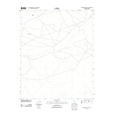
2011 Map of Arrowhead Butte
USGS Topo · Published 2011About this map
Arrowhead Butte rises from the high desert terrain of the Navajo Nation, serving as a prominent landmark in this northeastern corner of Arizona. This survey captures a landscape defined by its distinct geological formations and the essential transportation arteries that connect these remote reaches. The northern portion of the quadrangle is anchored by Smooth Butte, while the network of roads, including Indian Rte 157 and the thoroughfare N-9003, reveals the modern infrastructure overlaid upon traditional lands. The map illustrates a sparse but vital layout of ephemeral watercourses and tracks, reflecting a region where geography and movement are shaped by the open, arid environment and the presence of these distinctive volcanic or erosional buttes.
Find a feature on this map
4 named features on this map. Tap any name to fly to it.
Don’t see what you’re looking for? This feature index may not catch every label — zoom into the map to look around manually.
Map Details
Editions of this 2011 Arrowhead Butte Map
This is the sole edition of this map. No revisions or reprints were ever made.
Other maps of this area

1883 · Tusayan
USGS Topo · 1:250,000

1886 · Tusayan
USGS Topo · 1:250,000

1886 · Fort Defiance
USGS Topo · 1:250,000

1892 · Fort Defiance
USGS Topo · 1:250,000

1947 · Flagstaff
USGS Topo · 1:250,000

1954 · Flagstaff
USGS Topo · 1:250,000

1954 · Gallup
USGS Topo · 1:250,000

1958 · Gallup
USGS Topo · 1:250,000

1958 · Flagstaff
USGS Topo · 1:250,000

1959 · Gallup
USGS Topo · 1:250,000