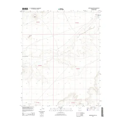
2014 Map of Arrowhead Butte
USGS Topo · Published 2014About this map
The Pueblo Colorado Valley dominates this high-elevation landscape, where the seasonal drainage of the Pueblo Colorado Wash snakes across the terrain. Rising distinctly from the surrounding plateau are several geologic landmarks, including the prominent volcanic-looking heights of Arrowhead Butte and Smooth Butte. The transportation network is defined by Bureau of Indian Affairs routes, specifically Bia-157 and Bia-9811, which provide access through these wide stretches of open country. This modern survey reflects a region primarily organized around public land divisions and reservation infrastructure, with Co Road 9003 skirting the southern edge of the survey area.
Find a feature on this map
13 named features on this map. Tap any name to fly to it.
Don’t see what you’re looking for? This feature index may not catch every label — zoom into the map to look around manually.
Map Details
Editions of this 2014 Arrowhead Butte Map
This is the sole edition of this map. No revisions or reprints were ever made.
Other maps of this area

1883 · Tusayan
USGS Topo · 1:250,000

1886 · Tusayan
USGS Topo · 1:250,000

1886 · Fort Defiance
USGS Topo · 1:250,000

1892 · Fort Defiance
USGS Topo · 1:250,000

1947 · Flagstaff
USGS Topo · 1:250,000

1954 · Flagstaff
USGS Topo · 1:250,000

1954 · Gallup
USGS Topo · 1:250,000

1958 · Gallup
USGS Topo · 1:250,000

1958 · Flagstaff
USGS Topo · 1:250,000

1959 · Gallup
USGS Topo · 1:250,000