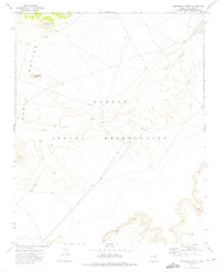
1972 Map of Arrowhead Butte
USGS Topo · Published 1975About this map
Navajo Indian Reservation lands dominate this 1970s topographic study, revealing a high-desert landscape defined by volcanic landforms and traditional seasonal water sources. The Hopi Buttes rise significantly above the surrounding terrain, with prominent landmarks such as Arrowhead Butte and Smooth Butte serving as critical navigational points. The drainage of Pueblo Colorado Wash meanders across the central portion of the map, illustrating the importance of ephemeral water systems in this arid region. Human activity and pastoral land use are marked by a network of unimproved tracks labeled as Jeep Tr and scattered infrastructure, including several Water Tanks and a isolated Well. This survey captures the region just before modern development, preserving the spatial relationship between these natural landmarks and the utilitarian needs of the local inhabitants.
Find a feature on this map
8 named features on this map. Tap any name to fly to it.
Don’t see what you’re looking for? This feature index may not catch every label — zoom into the map to look around manually.
Map Details
Editions of this 1972 Arrowhead Butte Map
This is the sole edition of this map. No revisions or reprints were ever made.
Other maps of this area

1883 · Tusayan
USGS Topo · 1:250,000

1886 · Tusayan
USGS Topo · 1:250,000

1886 · Fort Defiance
USGS Topo · 1:250,000

1892 · Fort Defiance
USGS Topo · 1:250,000

1947 · Flagstaff
USGS Topo · 1:250,000

1954 · Flagstaff
USGS Topo · 1:250,000

1954 · Gallup
USGS Topo · 1:250,000

1958 · Gallup
USGS Topo · 1:250,000

1958 · Flagstaff
USGS Topo · 1:250,000

1959 · Gallup
USGS Topo · 1:250,000