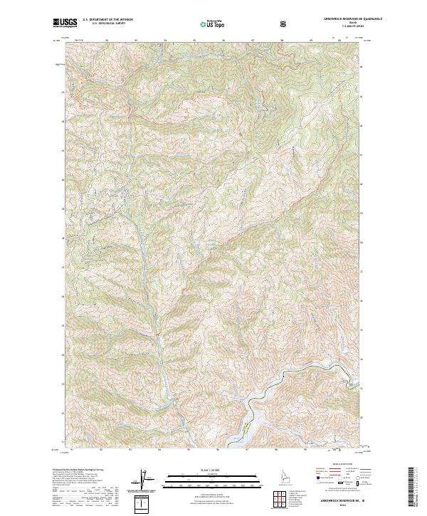
2024 Map of Arrowrock Reservoir NE
USGS Topo · Published 2024About this map
Boise National Forest encompasses the entirety of this mountain landscape, where the Boise River feeds into the northern reaches of the Arrowrock Reservoir. The drainage patterns here are complex, defined by the convergence of dozens of named gulches and creeks, such as the aptly named Switchback Gulch and Cottonwood-Bannock Creek. This is a landscape of high-elevation corridors, where the historic Atlanta Road and Trail Creek follow the natural contours of the river valleys to connect remote backcountry outposts.
Find a feature on this map
46 named features on this map. Tap any name to fly to it.
Don’t see what you’re looking for? This feature index may not catch every label — zoom into the map to look around manually.
Map Details
Editions of this 2024 Arrowrock Reservoir NE Map
This is the sole edition of this map. No revisions or reprints were ever made.
Other maps of this area

1894 · Idaho Basin
USGS Topo · 1:125,000

1955 · Hailey
USGS Topo · 1:250,000

1957 · Warm Springs Point
USGS Topo · 1:24,000

1957 · Idaho City
USGS Topo · 1:24,000

1959 · Hailey
USGS Topo · 1:250,000

1962 · Hailey
USGS Topo · 1:250,000

1964 · Twin Springs
USGS Topo · 1:24,000
1964 · Long Gulch
USGS Topo · 1:24,000

1969 · Dunnigan Creek
USGS Topo · 1:24,000
1969 · Arrowrock Reservoir NE
USGS Topo · 1:24,000