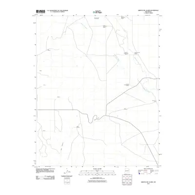
2010 Map of Arroyo Del Alamo
USGS Topo · Published 2010About this map
Carbon dioxide extraction infrastructure defines this Harding County landscape, where the Mitchell family name is tied to several carbonic well sites, including Carbonic Number Five Mitchell and Carbonic Number Seven Mitchell. These industrial footprints share the terrain with traditional ranching outposts like Bar T Cross Camp and several named windmills, such as Jake Windmill and Cedros Windmills, which indicate the vital role of groundwater management in this high-plains environment.
Find a feature on this map
20 named features on this map. Tap any name to fly to it.
Don’t see what you’re looking for? This feature index may not catch every label — zoom into the map to look around manually.
Map Details
Editions of this 2010 Arroyo Del Alamo Map
This is the sole edition of this map. No revisions or reprints were ever made.
Other maps of this area

1954 · Tucumcari
USGS Topo · 1:250,000

1958 · Tucumcari
USGS Topo · 1:250,000

1969 · Salitre Canyon
USGS Topo · 1:24,000

1969 · Chinaberry Canyon
USGS Topo · 1:24,000

1969 · Buffalo Springs
USGS Topo · 1:24,000

1973 · Circle Bar Ranch
USGS Topo · 1:24,000

1973 · Mosquero
USGS Topo · 1:24,000

1973 · Sabino
USGS Topo · 1:24,000
1973 · Bueyeros
USGS Topo · 1:24,000
1973 · Albert
USGS Topo · 1:24,000