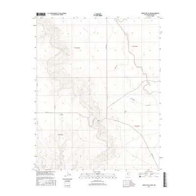
2017 Map of Arroyo Del Alamo
USGS Topo · Published 2017About this map
Ojos Canyon and the surrounding drainage of the Arroyo Del Alamo characterize this section of Harding County. The landscape is defined by its water sources, including Tejano Spring, McIntosh Spring, and Parras Spring, which have long served as vital points of interest in this arid environment. The presence of the David Cem and the nearby David Hill provides a tangible link to local family history and early settlement patterns.
Find a feature on this map
19 named features on this map. Tap any name to fly to it.
Don’t see what you’re looking for? This feature index may not catch every label — zoom into the map to look around manually.
Map Details
Editions of this 2017 Arroyo Del Alamo Map
This is the sole edition of this map. No revisions or reprints were ever made.
Other maps of this area

1954 · Tucumcari
USGS Topo · 1:250,000

1958 · Tucumcari
USGS Topo · 1:250,000

1969 · Salitre Canyon
USGS Topo · 1:24,000

1969 · Chinaberry Canyon
USGS Topo · 1:24,000

1969 · Buffalo Springs
USGS Topo · 1:24,000

1973 · Circle Bar Ranch
USGS Topo · 1:24,000

1973 · Mosquero
USGS Topo · 1:24,000

1973 · Sabino
USGS Topo · 1:24,000
1973 · Bueyeros
USGS Topo · 1:24,000
1973 · Albert
USGS Topo · 1:24,000