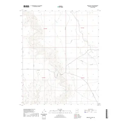
2020 Map of Arroyo Del Alamo
USGS Topo · Published 2020About this map
David Cem sits as a quiet landmark in this high-plains landscape of Harding County, marking local family history near the southern end of Tequesquite Cr. The terrain is defined by the sharp descent of Ojos Canyon and the prominent rise of David Hill, which overlooks a series of vital water sources. These include Tejano Spring to the west and the clustered Parras Spring and McIntosh Spring to the south.
Find a feature on this map
20 named features on this map. Tap any name to fly to it.
Don’t see what you’re looking for? This feature index may not catch every label — zoom into the map to look around manually.
Map Details
Editions of this 2020 Arroyo Del Alamo Map
This is the sole edition of this map. No revisions or reprints were ever made.
Other maps of this area

1954 · Tucumcari
USGS Topo · 1:250,000

1958 · Tucumcari
USGS Topo · 1:250,000

1969 · Salitre Canyon
USGS Topo · 1:24,000

1969 · Chinaberry Canyon
USGS Topo · 1:24,000

1969 · Buffalo Springs
USGS Topo · 1:24,000

1973 · Circle Bar Ranch
USGS Topo · 1:24,000

1973 · Mosquero
USGS Topo · 1:24,000

1973 · Sabino
USGS Topo · 1:24,000
1973 · Bueyeros
USGS Topo · 1:24,000
1973 · Albert
USGS Topo · 1:24,000