
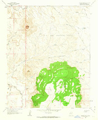
1961 Map of Arroyo Empedrado
USGS Topo · Published 1963About this map
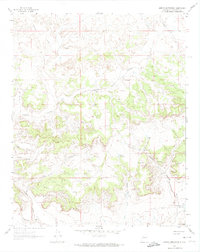
Mesa San Luis dominates this high-desert landscape in Sandoval County, defined by a complex network of seasonal drainage systems and natural water catchments. The mapping, based on 1958 aerial photography and field checked in 1961, shows a terrain shaped by the intermittent flows of the Torreon Wash and Arroyo Chico. Notable landmarks like Rincon Largo and Laguna de la Leña illustrate the vital importance of water management in this arid region. The inclusion of the Cabezon Community Reservoir in the southeastern corner highlights the intersection of the natural landscape and local resource needs during the mid-20th century. Numerous smaller arroyos, such as Arroyo Piedra Lumbre and Arroyo de Rosendo, weave between the mesas, marking the traditional routes and naming conventions of the area's residents.
Find a feature on this map
13 named features on this map. Tap any name to fly to it.
Don’t see what you’re looking for? This feature index may not catch every label — zoom into the map to look around manually.
Map Details
Editions of this 1961 Arroyo Empedrado Map
2 editions found
Other maps of this area

1883 · Mt. Taylor
USGS Topo · 1:250,000

1886 · Mt. Taylor
USGS Topo · 1:250,000

1892 · Mt. Taylor
USGS Topo · 1:250,000

1899 · Mt. Taylor
USGS Topo · 1:250,000

1958 · Albuquerque
USGS Topo · 1:250,000
1961 · Headcut Reservoir
USGS Topo · 1:24,000

1961 · Cerro Parido
USGS Topo · 1:24,000
1961 · Canada Calladita
USGS Topo · 1:24,000
1961 · Tinian
USGS Topo · 1:24,000
1961 · Cabezon Peak
USGS Topo · 1:24,000