Loading...
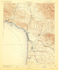
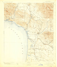
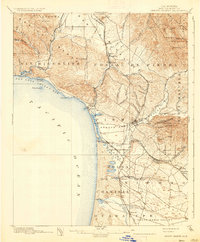
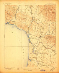
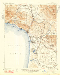
Loading map...1897 Map of Arroyo Grande
USGS Topo · Published 1918About this map
Arroyo Grande and the surrounding coastal valleys appear in this late 19th-century survey during a period of significant railway and agricultural development. The landscape is defined by the meeting of the Santa Lucia Range and the Pacific Ocean, with the narrow-gauge Pacific Coast Railway and the Southern Pacific Railroad tracing the interior valleys and shoreline. This era shows established coastal landings such as Mallagh Landing near Avila, alongside the early layouts of towns like Oceano and Grover.
Find a feature on this map
73 named features on this map. Tap any name to fly to it.
Don’t see what you’re looking for? This feature index may not catch every label — zoom into the map to look around manually.
Map Details
Date Portrayed1897
Date Published1918
PublisherU.S. Geological Survey
Map TypeTopographic
Scale1:62,500
Physical Dimensions16.6 x 19.7 inches
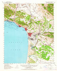
Editions of this 1897 Arroyo Grande Map
5 editions found

Historical Maps of San Luis Obispo Through Time
3 maps found
Featured Locations
Source Details
SourceU.S. Geological Survey
CopyrightPublic Domain