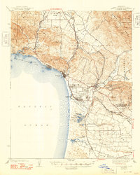
1942 Map of Arroyo Grande
USGS Topo · Published 1949About this map
Avila and Arroyo Grande anchor this central coast landscape, where the rugged San Luis Range meets the Pacific. The survey reveals a complex transportation network defined by two distinct rail systems: the Southern Pacific and the Pacific Coast (Narrow Gage), the latter winding through Price Canyon and serving the settlement at Edna. Local industry and social life are marked by features like Sycamore Springs and Mine Hill, alongside coastal developments at Pismo Beach and Oceano Beach.
Find a feature on this map
92 named features on this map. Tap any name to fly to it.
Don’t see what you’re looking for? This feature index may not catch every label — zoom into the map to look around manually.
Map Details
Editions of this 1942 Arroyo Grande Map
3 editions found

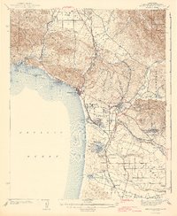
Other maps of this area

1897 · Port Harford
USGS Topo · 1:62,500

1897 · San Luis Obispo
USGS Topo · 1:62,500

1897 · Cayucos
USGS Topo · 1:62,500

1897 · Arroyo Grande
USGS Topo · 1:62,500

1900 · San Luis
USGS Topo · 1:125,000

1905 · Guadalupe
USGS Topo · 1:125,000

1905 · Lompoc
USGS Topo · 1:125,000

1922 · Pozo
USGS Topo · 1:62,500

1922 · Nipomo
USGS Topo · 1:62,500

1937 · Cayucos
USGS Topo · 1:62,500