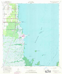
1956 Map of Arsenicker Keys
USGS Topo · Published 1970About this map
Homestead Air Force Base dominates the inland corner of this coastal survey, where the rigid grid of South Florida’s agricultural and military infrastructure meets the untamed mangrove shoreline. The map documents a pivotal transition in the mid-1950s, highlighting the industrial footprint of the Power Plant at Turkey Point and the complex drainage network of the Military Canal, Mowry Canal, and North Canal. These man-made channels cut through the landscape toward Biscayne Bay, illustrating the engineering efforts to manage the wetlands. Along the coast, the recreational grounds of Homestead Bayfront Park contrast with the primitive terrain of Turtle Point and the scatter of islands including West Arsenicker Key and Arsenicker Key. Offshore, the Intracoastal Waterway follows the deep water east of Spoil Banks, marking the vital maritime corridor of the era.
Find a feature on this map
39 named features on this map. Tap any name to fly to it.
Don’t see what you’re looking for? This feature index may not catch every label — zoom into the map to look around manually.
Map Details
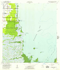
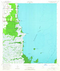
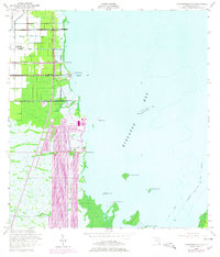
Editions of this 1956 Arsenicker Keys Map
4 editions found
Other maps of this area

1948 · Soldier Key
USGS Topo · 1:24,000

1949 · Elliott Key
USGS Topo · 1:24,000

1949 · Card Sound
USGS Topo · 1:24,000

1949 · Pacific Reef
USGS Topo · 1:24,000

1949 · Arsenicker Keys
USGS Topo · 1:24,000

1949 · Goulds
USGS Topo · 1:24,000

1949 · Perrine
USGS Topo · 1:24,000

1950 · Homestead
USGS Topo · 1:24,000

1950 · Glades
USGS Topo · 1:24,000

1956 · Goulds
USGS Topo · 1:24,000