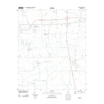
2012 Map of Artesia
USGS Topo · Published 2012About this map
Artesia and the surrounding agricultural landscapes of Lowndes and Oktibbeha counties are documented here in detail. The settlement of Sessums sits along Railroad Spur Rd, while the town of Artesia is defined by its grid near Bush Crossing and Railroad St. This area is particularly rich in family and community history, evidenced by a high density of burial grounds including Fox Cem, Rice Cem, Sessums Cem, Seitz Cem, Curtis Chapel Cem, and Peters Cem.
Find a feature on this map
83 named features on this map. Tap any name to fly to it.
Don’t see what you’re looking for? This feature index may not catch every label — zoom into the map to look around manually.
Map Details
Editions of this 2012 Artesia Map
This is the sole edition of this map. No revisions or reprints were ever made.
Other maps of this area

1953 · West Point
USGS Topo · 1:250,000

1958 · West Point
USGS Topo · 1:250,000

1959 · Artesia
USGS Topo · 1:62,500

1959 · West Point
USGS Topo · 1:62,500

1959 · Pheba
USGS Topo · 1:62,500

1963 · West Point
USGS Topo · 1:250,000

1965 · Starkville
USGS Topo · 1:24,000

1965 · Bluff Lake
USGS Topo · 1:24,000

1982 · West Point
USGS Topo · 1:100,000

1984 · West Point
USGS Topo · 1:250,000