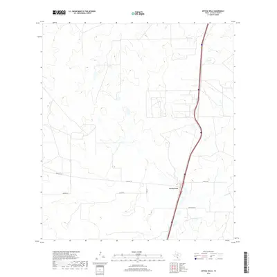
2019 Map of Artesia Wells
USGS Topo · Published 2019About this map
Artesia Wells sits along the interstate corridor in this South Texas landscape, serving as a primary point of reference in La Salle County. The terrain is defined by the ephemeral drainage of Las Raices Cr to the southeast and a network of rural routes that link regional ranching operations. Roads like Ranch Rd 133 and Snowden Rd cut across the contours, reflecting the sparse, organized development of the modern ranching era. The placement of Cemetery Rd east of the main settlement suggests the historical footprint of the local community. This survey, compiled from data ranging through 2018, documents the infrastructure of a region where large-scale land parcels and transportation routes dominate the landscape.
Find a feature on this map
8 named features on this map. Tap any name to fly to it.
Don’t see what you’re looking for? This feature index may not catch every label — zoom into the map to look around manually.
Map Details
Editions of this 2019 Artesia Wells Map
This is the sole edition of this map. No revisions or reprints were ever made.
Other maps of this area

1927 · Bart
USGS Topo · 1:62,500

1929 · Cotulla
USGS Topo · 1:125,000

1940 · Cotulla
USGS Topo · 1:62,500

1940 · Artesia Wells
USGS Topo · 1:62,500

1953 · Crystal City
USGS Topo · 1:250,000

1955 · Crystal City
USGS Topo · 1:250,000

1957 · Encinal
USGS Topo · 1:62,500

1957 · Caiman Creek
USGS Topo · 1:62,500

1961 · Crystal City
USGS Topo · 1:250,000

1968 · Crystal City
USGS Topo · 1:250,000