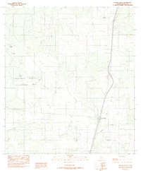
1982 Map of Artesia Wells
USGS Topo · Published 1982About this map
The brush country of La Salle Co is defined here by the transit corridor of the Missouri Pacific railroad and the concentrated settlement at Artesia Wells. This 1982 provisional map captures the region's ranching and industrial infrastructure, where water management is critical as evidenced by numerous features like Moras Tank and Scotty Tank. The drainage of Las Raices Creek cuts across the southern portion of the quadrangle, while the western half is dominated by the Chaparral Wildlife Management Area. Energy and aviation footprints are visible through the inclusion of a Pump Station and a local Landing Strip, illustrating the functional landscape of South Texas during the early 1980s.
Find a feature on this map
13 named features on this map. Tap any name to fly to it.
Don’t see what you’re looking for? This feature index may not catch every label — zoom into the map to look around manually.
Map Details
Editions of this 1982 Artesia Wells Map
This is the sole edition of this map. No revisions or reprints were ever made.
Other maps of this area

1927 · Bart
USGS Topo · 1:62,500

1929 · Cotulla
USGS Topo · 1:125,000

1940 · Cotulla
USGS Topo · 1:62,500

1940 · Artesia Wells
USGS Topo · 1:62,500

1953 · Crystal City
USGS Topo · 1:250,000

1955 · Crystal City
USGS Topo · 1:250,000

1957 · Encinal
USGS Topo · 1:62,500

1957 · Caiman Creek
USGS Topo · 1:62,500

1961 · Crystal City
USGS Topo · 1:250,000

1968 · Crystal City
USGS Topo · 1:250,000