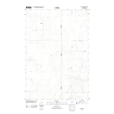
2013 Map of Arthyde
USGS Topo · Published 2013About this map
Arthyde and Ellson anchor this rural landscape along the boundary of Aitkin and Pine Counties in northern Minnesota. This 2013 survey illustrates a region defined by its complex network of small waterways and wetlands, where the Snake River and Chelsey Brook meander through the western terrain. The settlement pattern is sparse, connected by a mix of established routes like Wagon Wheel Rd and more utilitarian paths such as Herubin Truck Trl and Giese Truck Trl. To the south, Rhine Lake feeds into Rhine Cr, part of a drainage system that includes Bremen Cr and Little Bremen Cr. The map provides a clear look at the transitional nature of this timber and peatland country, where logging and transport history is reflected in the naming of truck trails and rural lanes that cut through the low-lying glacial topography.
Find a feature on this map
24 named features on this map. Tap any name to fly to it.
Don’t see what you’re looking for? This feature index may not catch every label — zoom into the map to look around manually.
Map Details
Editions of this 2013 Arthyde Map
This is the sole edition of this map. No revisions or reprints were ever made.
Other maps of this area

1953 · Duluth
USGS Topo · 1:250,000

1958 · Duluth
USGS Topo · 1:250,000

1961 · Sandstone
USGS Topo · 1:62,500

1961 · Moose Lake
USGS Topo · 1:62,500

1968 · Kroschel NW
USGS Topo · 1:24,000

1968 · Giese
USGS Topo · 1:24,000

1969 · Solana
USGS Topo · 1:24,000

1969 · Arthyde
USGS Topo · 1:24,000

1969 · Split Rock Lake
USGS Topo · 1:24,000

1969 · Ronald
USGS Topo · 1:24,000