
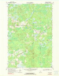
1969 Map of Solana
USGS Topo · Published 1971About this map
White Pine State Forest and Pliny State Forest cover much of this landscape in Aitkin County, revealing a terrain heavily shaped by forestry and early transportation. The tiny settlement of Solana serves as a focal point along the Soo Line tracks, which bisect the southern half of the quadrangle. North of this active rail line, an Old Railroad Grade snakes through the wetlands, hinting at a previous era of timber extraction that once dominated the region. The industrial utility of the forest is underscored by the network of service roads, including the White Pine Truck Trail and Herubin Truck Trail. Fire prevention infrastructure is represented by the White Pine Lookout Tower, a critical landmark for monitoring the timberlands. Natural drainage is provided by the winding Snake River and Chelsea Brook, while Twentyone Lake sits in the far northwestern corner.
Find a feature on this map
14 named features on this map. Tap any name to fly to it.
Don’t see what you’re looking for? This feature index may not catch every label — zoom into the map to look around manually.
Map Details
Editions of this 1969 Solana Map
2 editions found
Other maps of this area

1953 · Duluth
USGS Topo · 1:250,000

1958 · Duluth
USGS Topo · 1:250,000

1968 · Kroschel NW
USGS Topo · 1:24,000

1968 · Giese
USGS Topo · 1:24,000

1968 · Mc Grath
USGS Topo · 1:24,000

1969 · Arthyde
USGS Topo · 1:24,000

1969 · Thor NE
USGS Topo · 1:24,000

1969 · Thor SE
USGS Topo · 1:24,000

1969 · Split Rock Lake
USGS Topo · 1:24,000

1969 · Ronald
USGS Topo · 1:24,000