
1968 Map of Mc Grath
USGS Topo · Published 1970About this map
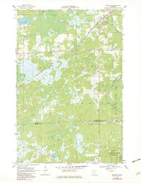
The settlement of McGrath anchors the upper corner of this survey, where the Soo Line railroad intersects with local roads in a landscape dominated by the winding path of the Snake River. In the late 1960s, this area on the border of Aitkin Co and Kanabec Co remained a mix of wetlands and wooded tracts, exemplified by the Hay-Snake State Wildlife Management Area and the Snake River County Park. Local genealogy and land use are evidenced by Grace Cem near town and the small community of Bergman further south along Hay Brook. The map captures a transition in transportation, showing both the primary rail infrastructure and seasonal routes like the Winter Trail crossing the marshes near Bear Lake. Natural resources are marked by several locations of Gravel Pit, suggesting the importance of road building and local industry in this rural Minnesota township.
Find a feature on this map
19 named features on this map. Tap any name to fly to it.
Don’t see what you’re looking for? This feature index may not catch every label — zoom into the map to look around manually.
Map Details
Editions of this 1968 Mc Grath Map
2 editions found
Other maps of this area

1953 · Duluth
USGS Topo · 1:250,000

1958 · Duluth
USGS Topo · 1:250,000

1968 · Kroschel NW
USGS Topo · 1:24,000

1968 · Isle SW
USGS Topo · 1:24,000

1968 · Isle
USGS Topo · 1:24,000

1968 · Pomroy Lake
USGS Topo · 1:24,000

1968 · Warman
USGS Topo · 1:24,000

1969 · Solana
USGS Topo · 1:24,000

1969 · Thor SE
USGS Topo · 1:24,000

1969 · Thor SW
USGS Topo · 1:24,000