
1969 Map of Thor SW
USGS Topo · Published 1971About this map
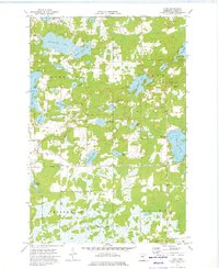
Malmo, Lakeside, and Seavey townships define this section of Aitkin County, characterized by a complex network of wetlands and small water bodies. The landscape is primarily defined by the drainage patterns of Borden Creek and Peterson Creek, which wind through the low-lying terrain. Several small family and community burial grounds, including Malmo Cem, Lakeside Cem, and Ostlund Cem, are scattered across the higher ground, providing valuable location data for genealogists and local historians. The presence of a local Townhall and multiple Gravel Pits suggests a rural economy tied to small-scale industry and local administration during the late 1960s. The map illustrates the sparse settlement patterns typical of this region of Minnesota, where roads often follow section lines to navigate the surrounding marshes.
Find a feature on this map
10 named features on this map. Tap any name to fly to it.
Don’t see what you’re looking for? This feature index may not catch every label — zoom into the map to look around manually.
Map Details
Editions of this 1969 Thor SW Map
This is the sole edition of this map. No revisions or reprints were ever made.
Other maps of this area

1916 · Wealthwood
USGS Topo · 1:62,500

1953 · Duluth
USGS Topo · 1:250,000

1958 · Duluth
USGS Topo · 1:250,000

1968 · Wahkon North
USGS Topo · 1:24,000

1968 · Isle
USGS Topo · 1:24,000

1968 · Mc Grath
USGS Topo · 1:24,000

1969 · Thor NE
USGS Topo · 1:24,000

1969 · Thor SE
USGS Topo · 1:24,000

1969 · Thor
USGS Topo · 1:24,000
1973 · Glen
USGS Topo · 1:24,000