
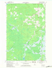
1969 Map of Thor NE
USGS Topo · Published 1971About this map
The Rice Lake National Wildlife Refuge and Solana State Forest dominate this landscape in eastern Aitkin County, showcasing the transition between managed conservation lands and northern woods. In the late 1960s, this area retained a distinctly rural and sparse character, with the Rice River and Dam Brook carving through the terrain toward the marshy expanse of Rice Lake. Human presence is anchored by a few community landmarks, such as the local Townhall and St Johns Ch, while the local economy is evidenced by scattered Gravel Pits found near the river. The map also records remote water bodies like Porcupine Lake and Beckman Creek, providing a detailed look at the drainage patterns and wetlands that define this part of the state.
Find a feature on this map
13 named features on this map. Tap any name to fly to it.
Don’t see what you’re looking for? This feature index may not catch every label — zoom into the map to look around manually.
Map Details
Editions of this 1969 Thor NE Map
2 editions found
Other maps of this area

1953 · Duluth
USGS Topo · 1:250,000

1958 · Duluth
USGS Topo · 1:250,000

1969 · Solana
USGS Topo · 1:24,000

1969 · Thor SE
USGS Topo · 1:24,000

1969 · Thor SW
USGS Topo · 1:24,000

1969 · Thor
USGS Topo · 1:24,000

1969 · Split Rock Lake
USGS Topo · 1:24,000

1969 · Lawler
USGS Topo · 1:24,000

1970 · Kimberly
USGS Topo · 1:24,000

1970 · Mc Gregor
USGS Topo · 1:24,000