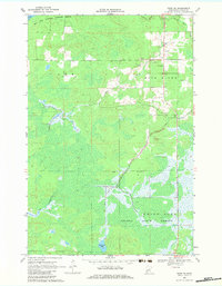
1969 Map of Thor NE
USGS Topo · Published 1983About this map
Rice Lake National Wildlife Refuge and the southern reaches of Solana State Forest dominate this Aitkin County landscape, characterized by extensive wetlands and slow-moving water systems. The Rice River meanders across the center of the sheet, fed by smaller tributaries like Five Creek and Brook. Human activity is concentrated along the north-south roadway on the eastern edge, where the rural settlement of Beckman and the community Townhall are located.
Find a feature on this map
16 named features on this map. Tap any name to fly to it.
Don’t see what you’re looking for? This feature index may not catch every label — zoom into the map to look around manually.
Map Details
Editions of this 1969 Thor NE Map
2 editions found
Other maps of this area

1953 · Duluth
USGS Topo · 1:250,000

1958 · Duluth
USGS Topo · 1:250,000

1969 · Solana
USGS Topo · 1:24,000

1969 · Thor NE
USGS Topo · 1:24,000

1969 · Thor SE
USGS Topo · 1:24,000

1969 · Thor SW
USGS Topo · 1:24,000

1969 · Thor
USGS Topo · 1:24,000

1969 · Split Rock Lake
USGS Topo · 1:24,000

1969 · Lawler
USGS Topo · 1:24,000

1970 · Kimberly
USGS Topo · 1:24,000