
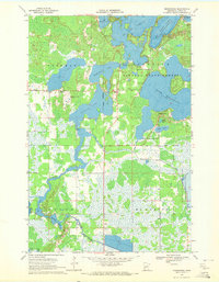
1970 Map of Mc Gregor
USGS Topo · Published 1972About this map
The settlement of Mc Gregor serves as a central hub in this northern Minnesota landscape, situated at the junction of the Burlington Northern railroad and regional roadways. The terrain is defined by a complex mosaic of wetlands and water bodies, most notably the expansive Rice Lake and the winding Rice River. These natural features are heavily protected within the Rice Lake National Wildlife Refuge and the Kimberly State Wildlife Management Area, reflecting the region's historical commitment to conservation.
Find a feature on this map
28 named features on this map. Tap any name to fly to it.
Don’t see what you’re looking for? This feature index may not catch every label — zoom into the map to look around manually.
Map Details
Editions of this 1970 Mc Gregor Map
This is the sole edition of this map. No revisions or reprints were ever made.
Other maps of this area

1953 · Duluth
USGS Topo · 1:250,000

1958 · Duluth
USGS Topo · 1:250,000

1969 · Thor NE
USGS Topo · 1:24,000

1969 · Thor
USGS Topo · 1:24,000

1969 · Split Rock Lake
USGS Topo · 1:24,000

1969 · Lawler
USGS Topo · 1:24,000

1970 · Kimberly
USGS Topo · 1:24,000

1970 · Tamarack
USGS Topo · 1:24,000

1970 · Palisade
USGS Topo · 1:24,000
1970 · Minnewawa
USGS Topo · 1:24,000