
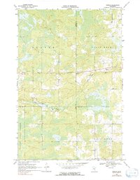
1969 Map of Ronald
USGS Topo · Published 1971About this map
The Ronald settlement sits at the junction of several county lines in this late 1960s survey of eastern Minnesota. The landscape is defined by the headwaters of the Split Rock River and Birch Creek, which wind through a mosaic of wetlands and timber within the Solina State Forest. This area highlights the transition from managed forest land to small agricultural clearings, with the Beaver Ch serving as a local landmark for the surrounding Beaver township. The map provides a look at the rural infrastructure of the era, from the scattered Gravel Pits used for road maintenance to the precise boundaries where Aitkin, Carlton, and Pine counties converge. Local family history and land-use researchers can find value in the specific placement of farmsteads and rural roads that connect these small northern communities.
Find a feature on this map
11 named features on this map. Tap any name to fly to it.
Don’t see what you’re looking for? This feature index may not catch every label — zoom into the map to look around manually.
Map Details
Editions of this 1969 Ronald Map
2 editions found
Other maps of this area

1953 · Duluth
USGS Topo · 1:250,000

1958 · Duluth
USGS Topo · 1:250,000

1961 · Cromwell
USGS Topo · 1:62,500

1961 · Moose Lake
USGS Topo · 1:62,500

1969 · Solana
USGS Topo · 1:24,000

1969 · Arthyde
USGS Topo · 1:24,000

1969 · Split Rock Lake
USGS Topo · 1:24,000

1969 · Automba
USGS Topo · 1:24,000

1969 · Lawler
USGS Topo · 1:24,000

1980 · Sandstone
USGS Topo · 1:100,000