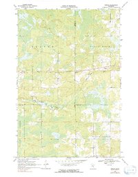
1969 Map of Ronald
USGS Topo · Published 1991About this map
The boundary lines of Aitkin, Carlton, and Pine counties converge in this late-1960s survey of east-central Minnesota. The landscape is defined by the winding course of the Split Rock River and its companion, Birch Creek, which carve through a mosaic of wetlands and forested terrain. The small community of Ronald sits along a secondary road near the river, serving as a focal point in a largely rural area dominated by the northern reaches of the Solana State Forest.
Find a feature on this map
13 named features on this map. Tap any name to fly to it.
Don’t see what you’re looking for? This feature index may not catch every label — zoom into the map to look around manually.
Map Details
Editions of this 1969 Ronald Map
2 editions found
Other maps of this area

1953 · Duluth
USGS Topo · 1:250,000

1958 · Duluth
USGS Topo · 1:250,000

1961 · Cromwell
USGS Topo · 1:62,500

1961 · Moose Lake
USGS Topo · 1:62,500

1969 · Solana
USGS Topo · 1:24,000

1969 · Arthyde
USGS Topo · 1:24,000

1969 · Split Rock Lake
USGS Topo · 1:24,000

1969 · Ronald
USGS Topo · 1:24,000

1969 · Automba
USGS Topo · 1:24,000

1969 · Lawler
USGS Topo · 1:24,000