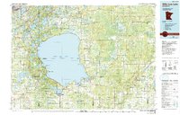
1985 Map of Mille Lacs Lake
USGS Topo · Published 1991About this map
Mille Lacs Lake anchors this mid-1980s landscape, surrounded by an extensive network of conservation lands and small lakeside settlements. To the south and west, Mille Lacs Kathio State Park and Father Hennepin State Park preserve the shoreline, while the Rice Lake National Wildlife Refuge and Solana State Forest extend into the marshy timberlands to the north and east. The map captures the region's transition from a rail-dependent economy to a recreational one, with the Burlington Northern railroad running through northern towns like Crosby and Deerwood, while small lakeside communities such as Garrison and Wahkon serve as gateways to the water. Dozens of smaller lakes, including Serpent Lake and Farm Island Lake, dot the glacial terrain, providing a look at the intricate drainage patterns of the Rice River and Ripple River systems.
Find a feature on this map
111 named features on this map. Tap any name to fly to it.
Don’t see what you’re looking for? This feature index may not catch every label — zoom into the map to look around manually.
Map Details
Editions of this 1985 Mille Lacs Lake Map
2 editions found
Other maps of this area

1912 · Deerwood
USGS Topo · 1:62,500

1913 · Cuyuna
USGS Topo · 1:62,500

1914 · Deerwood
USGS Topo · 1:62,500

1914 · Aitkin
USGS Topo · 1:62,500

1915 · Aitkin
USGS Topo · 1:62,500

1915 · Cuyuna
USGS Topo · 1:62,500

1915 · Brainerd
USGS Topo · 1:62,500

1916 · Wealthwood
USGS Topo · 1:62,500

1918 · Brainerd
USGS Topo · 1:62,500

1948 · Pierz
USGS Topo · 1:62,500