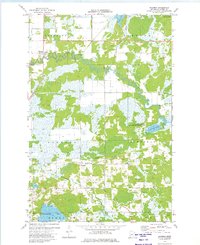
1973 Map of Hassman
USGS Topo · Published 1975About this map
The Rice River meanders heavily through this Aitkin County landscape, defining the topography near the settlements of Hassman and Rossburg. This mid-1970s survey illustrates a rural region defined by its wetlands and conservation efforts, most notably within the Newstrom State Wildlife Management Area. The transport network shows a significant transition, with the Northern Pacific Railroad (Abandoned) cutting a straight line across the townships of Spencer, Morrison, and Kimberly. Genealogists and local historians can find the Forest Cem located in the southeastern portion of the map, while the various lakes, including Sisabagama Lake, Fleming Lake, and Newstrom Lake, highlight the watery character of the Nordland and Glen township areas.
Find a feature on this map
22 named features on this map. Tap any name to fly to it.
Don’t see what you’re looking for? This feature index may not catch every label — zoom into the map to look around manually.
Map Details
Editions of this 1973 Hassman Map
This is the sole edition of this map. No revisions or reprints were ever made.
Other maps of this area

1914 · Aitkin
USGS Topo · 1:62,500

1915 · Aitkin
USGS Topo · 1:62,500

1916 · Wealthwood
USGS Topo · 1:62,500

1953 · Duluth
USGS Topo · 1:250,000

1958 · Duluth
USGS Topo · 1:250,000

1969 · Thor
USGS Topo · 1:24,000

1970 · Kimberly
USGS Topo · 1:24,000

1970 · Palisade
USGS Topo · 1:24,000
1973 · Waukenabo
USGS Topo · 1:24,000
1973 · Esquagamah Lake
USGS Topo · 1:24,000