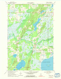
1970 Map of Kimberly
USGS Topo · Published 1991About this map
The settlement of Kimberly serves as the focal point for this landscape in Aitkin County, where the Burlington Northern railroad and an Old Railroad Grade trace the legacy of timber and transport through the marshlands. This 1970 survey reveals an area defined by its complex hydrology, with the winding Rice River and the Portage Branch connecting a series of significant water bodies including Portage Lake, Dam Lake, and the expansive Rice Lake. Large portions of the territory are dedicated to conservation, most notably the Rice Lake National Wildlife Refuge and the Kimberly State Wildlife Management Area, highlighting the region's importance for waterfowl and migratory habitat.
Find a feature on this map
27 named features on this map. Tap any name to fly to it.
Don’t see what you’re looking for? This feature index may not catch every label — zoom into the map to look around manually.
Map Details
Editions of this 1970 Kimberly Map
2 editions found
Other maps of this area

1914 · Aitkin
USGS Topo · 1:62,500

1915 · Aitkin
USGS Topo · 1:62,500

1916 · Wealthwood
USGS Topo · 1:62,500

1953 · Duluth
USGS Topo · 1:250,000

1958 · Duluth
USGS Topo · 1:250,000

1969 · Thor NE
USGS Topo · 1:24,000

1969 · Thor
USGS Topo · 1:24,000

1970 · Kimberly
USGS Topo · 1:24,000

1970 · Mc Gregor
USGS Topo · 1:24,000

1970 · Palisade
USGS Topo · 1:24,000