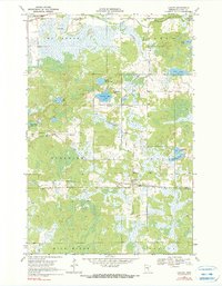
1969 Map of Lawler
USGS Topo · Published 1990About this map
The settlement of Lawler serves as a small hub in this wetland-heavy region of Aitkin County, situated where the Soo Line railroad cuts across the lowlands. The landscape is defined by an intricate network of water and marsh, including Sheriff Lake, Rice Lake, and Sandbacka Lake, connected by drainage such as Wakefield Brook and the Sandy River. Cultural markers are concentrated in small clearings, with several community landmarks like Tamarack Ch and the Sheriff Lake Tabernacle providing focal points for local history research.
Find a feature on this map
29 named features on this map. Tap any name to fly to it.
Don’t see what you’re looking for? This feature index may not catch every label — zoom into the map to look around manually.
Map Details
Editions of this 1969 Lawler Map
2 editions found
Other maps of this area

1953 · Duluth
USGS Topo · 1:250,000

1958 · Duluth
USGS Topo · 1:250,000

1969 · Thor NE
USGS Topo · 1:24,000

1969 · Split Rock Lake
USGS Topo · 1:24,000

1969 · Ronald
USGS Topo · 1:24,000

1969 · Automba
USGS Topo · 1:24,000

1969 · Lawler
USGS Topo · 1:24,000

1970 · Mc Gregor
USGS Topo · 1:24,000

1970 · Tamarack
USGS Topo · 1:24,000

1970 · Wright
USGS Topo · 1:24,000