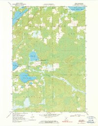
1969 Map of Thor
USGS Topo · Published 1990About this map
Rice Lake National Wildlife Refuge and the Swamp Lake State Wildlife Management Area dominate this northern landscape, which is defined by an intricate network of wetlands, marshes, and interconnected lakes. The small settlement of Thor sits at a rural crossroads in the north-central portion of the quadrangle, serving as a focal point for the surrounding townships of Glen, Lee, and Malmo.
Find a feature on this map
22 named features on this map. Tap any name to fly to it.
Don’t see what you’re looking for? This feature index may not catch every label — zoom into the map to look around manually.
Map Details
Editions of this 1969 Thor Map
2 editions found
Other maps of this area

1914 · Aitkin
USGS Topo · 1:62,500

1915 · Aitkin
USGS Topo · 1:62,500

1916 · Wealthwood
USGS Topo · 1:62,500

1953 · Duluth
USGS Topo · 1:250,000

1958 · Duluth
USGS Topo · 1:250,000

1969 · Thor NE
USGS Topo · 1:24,000

1969 · Thor SE
USGS Topo · 1:24,000

1969 · Thor SW
USGS Topo · 1:24,000

1969 · Thor
USGS Topo · 1:24,000

1970 · Kimberly
USGS Topo · 1:24,000