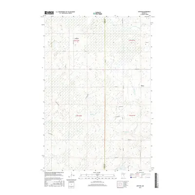
2016 Map of Arthyde
USGS Topo · Published 2016About this map
Arthyde and the small settlement of Ellson anchor this northern Minnesota landscape, characterized by the dense wetlands and woods of the Aitkin Co Forestry. The terrain is defined by a complex drainage system where the Snake River and Chelsea Brook wind through low-lying marshlands. This 2016 survey captures the area along the Aitkin Co and Pine Co border, revealing a network of rural timber and forest roads such as Herubin Forest Rd and Giese Forest Rd. The map illustrates the hydrological patterns of the region, from the headwaters of Birch Cr in the north to Rhine Lake and Rhine Cr in the south. The distribution of these water bodies, including Bremen Cr and Little Bremen Cr, dictates the placement of isolated residences and the limited road infrastructure that services this timber-rich environment.
Find a feature on this map
34 named features on this map. Tap any name to fly to it.
Don’t see what you’re looking for? This feature index may not catch every label — zoom into the map to look around manually.
Map Details
Editions of this 2016 Arthyde Map
This is the sole edition of this map. No revisions or reprints were ever made.
Other maps of this area

1953 · Duluth
USGS Topo · 1:250,000

1958 · Duluth
USGS Topo · 1:250,000

1961 · Sandstone
USGS Topo · 1:62,500

1961 · Moose Lake
USGS Topo · 1:62,500

1968 · Kroschel NW
USGS Topo · 1:24,000

1968 · Giese
USGS Topo · 1:24,000

1969 · Solana
USGS Topo · 1:24,000

1969 · Arthyde
USGS Topo · 1:24,000

1969 · Split Rock Lake
USGS Topo · 1:24,000

1969 · Ronald
USGS Topo · 1:24,000