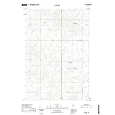
2019 Map of Arthyde
USGS Topo · Published 2019About this map
Arthyde and the surrounding Aitkin County timberlands are defined by a complex network of wetlands and small watercourses that drain toward the Snake River. This 2019 survey captures the quiet, rural character of the region, where small settlements like Ellson are connected by forest roads such as Giese Forest Rd and Herubin Forest Rd. The topography is dominated by extensive marshlands, through which winding streams like Bremen Cr, Little Bremen Cr, and Chelsea Brook carve slow paths. To the southeast, the terrain transitions into the area surrounding Rhine Lake, which serves as a notable hydrologic feature feeding into Rhine Cr. The map illustrates a landscape where human presence is concentrated along corridors like Co HWY 41 and Maple RD, leaving much of the interior to its natural state of bogs and birch-lined creeks.
Find a feature on this map
33 named features on this map. Tap any name to fly to it.
Don’t see what you’re looking for? This feature index may not catch every label — zoom into the map to look around manually.
Map Details
Editions of this 2019 Arthyde Map
This is the sole edition of this map. No revisions or reprints were ever made.
Other maps of this area

1953 · Duluth
USGS Topo · 1:250,000

1958 · Duluth
USGS Topo · 1:250,000

1961 · Sandstone
USGS Topo · 1:62,500

1961 · Moose Lake
USGS Topo · 1:62,500

1968 · Kroschel NW
USGS Topo · 1:24,000

1968 · Giese
USGS Topo · 1:24,000

1969 · Solana
USGS Topo · 1:24,000

1969 · Arthyde
USGS Topo · 1:24,000

1969 · Split Rock Lake
USGS Topo · 1:24,000

1969 · Ronald
USGS Topo · 1:24,000