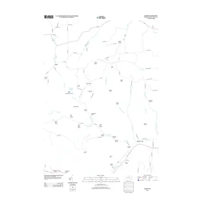
2013 Map of Asaph
USGS Topo · Published 2013About this map
Marsh Creek and the small settlement of Asaph sit at the intersection of several branching valley systems in this Tioga County landscape. The area is defined by a dense network of named hollows and ridges, including Osgood Hollow, Parker Hollow, and Broad Ridge. The terrain supports unique environmental and historical landmarks, from the Black Ash Swamp Natural Area to the Hessel Gesser Millstone located near Bear Wallow. Drainage is complex, with Asaph Run split into its Left and Right branches before joining the larger flow of Marsh Creek near the southern edge of the sheet. High points such as Mount Nesmuk and South Hill overlook a network of rural roads and the Goodall Fire Tower, reflecting a region tied to forestry and small-scale aviation at Sharretts Airport.
Find a feature on this map
101 named features on this map. Tap any name to fly to it.
Don’t see what you’re looking for? This feature index may not catch every label — zoom into the map to look around manually.
Map Details
Editions of this 2013 Asaph Map
This is the sole edition of this map. No revisions or reprints were ever made.
Other maps of this area

1899 · Gaines
USGS Topo · 1:62,500

1900 · Gaines
USGS Topo · 1:62,500

1900 · Elkland
USGS Topo · 1:62,500

1946 · Tiadaghton
USGS Topo · 1:24,000

1946 · Antrim
USGS Topo · 1:62,500

1946 · Antrim
USGS Topo · 1:24,000

1947 · Galeton
USGS Topo · 1:62,500

1947 · Marshlands
USGS Topo · 1:24,000

1948 · Antrim
USGS Topo · 1:24,000
1948 · Tiadaghton
USGS Topo · 1:24,000