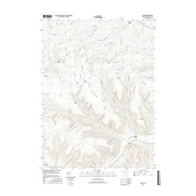
2016 Map of Asaph
USGS Topo · Published 2016About this map
Asaph and Marsh Creek anchor the southeastern corner of this terrain study, where the valley floor meets a complex network of ridges and hollows in Tioga County. The landscape is defined by its deep drainages, including Hornby Hollow, Daggett Hollow, and Scotch Pine Hollow, which carve through the high ground of Broad Ridge and Mid Ridge. In the northwestern corner, the small settlement of Azelta sits near Jemison Cr, while Sharretts Airport provides a point of aviation infrastructure amidst the timbered hills. The presence of features like Log Slide Trail and Quarry Trl suggests a history of local resource extraction and forest management. High points like Mt Nesmuk overlook the winding paths of Left Straight Run and Right Straight Run, illustrating the challenging topography that has historically shaped movement and settlement patterns in this part of Pennsylvania.
Find a feature on this map
103 named features on this map. Tap any name to fly to it.
Don’t see what you’re looking for? This feature index may not catch every label — zoom into the map to look around manually.
Map Details
Editions of this 2016 Asaph Map
This is the sole edition of this map. No revisions or reprints were ever made.
Other maps of this area

1899 · Gaines
USGS Topo · 1:62,500

1900 · Gaines
USGS Topo · 1:62,500

1900 · Elkland
USGS Topo · 1:62,500

1946 · Tiadaghton
USGS Topo · 1:24,000

1946 · Antrim
USGS Topo · 1:62,500

1946 · Antrim
USGS Topo · 1:24,000

1947 · Galeton
USGS Topo · 1:62,500

1947 · Marshlands
USGS Topo · 1:24,000

1948 · Antrim
USGS Topo · 1:24,000
1948 · Tiadaghton
USGS Topo · 1:24,000