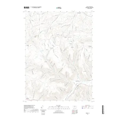
2019 Map of Asaph
USGS Topo · Published 2019About this map
Marsh Creek winds through the southern reaches of this Tioga County landscape, connecting the small settlements of Asaph and Rexford. The terrain is defined by a dense network of high ridges and deeply incised hollows, many bearing the names of local families and geographical quirks, such as Hornsby Hollow, Schanbacher Hollow, and the descriptively named Frying Pan Hollow. This 2019 survey shows the area's intricate drainage system where Left Asaph Run and Right Asaph Run converge, surrounded by upland features like Mid Ridge and Broad Ridge.
Find a feature on this map
103 named features on this map. Tap any name to fly to it.
Don’t see what you’re looking for? This feature index may not catch every label — zoom into the map to look around manually.
Map Details
Editions of this 2019 Asaph Map
This is the sole edition of this map. No revisions or reprints were ever made.
Other maps of this area

1899 · Gaines
USGS Topo · 1:62,500

1900 · Gaines
USGS Topo · 1:62,500

1900 · Elkland
USGS Topo · 1:62,500

1946 · Tiadaghton
USGS Topo · 1:24,000

1946 · Antrim
USGS Topo · 1:62,500

1946 · Antrim
USGS Topo · 1:24,000

1947 · Galeton
USGS Topo · 1:62,500

1947 · Marshlands
USGS Topo · 1:24,000

1948 · Antrim
USGS Topo · 1:24,000
1948 · Tiadaghton
USGS Topo · 1:24,000