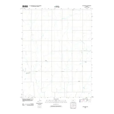
2009 Map of Ash Grove
USGS Topo · Published 2009About this map
Ash Grove and Victor anchor this rural Mitchell County landscape, where the agricultural grid is defined by a network of drainage systems and local roads. The terrain is marked by the courses of Rock Creek, West Rock Creek, and Trail Creek, which carve subtle paths through the Kansas plains. For those researching family history in the area, the map identifies three distinct burial grounds: Patterson Cemetery near the center of the quadrangle, Bethany Cemetery to the east, and Trail Creek Cemetery in the southern reaches. This modern survey reflects a sparsely populated region where the infrastructure of country life—represented by routes like Ash Grove Rd and Union Dr—remains essential for connecting isolated farmsteads and rural communities.
Find a feature on this map
18 named features on this map. Tap any name to fly to it.
Don’t see what you’re looking for? This feature index may not catch every label — zoom into the map to look around manually.
Map Details
Editions of this 2009 Ash Grove Map
This is the sole edition of this map. No revisions or reprints were ever made.
Other maps of this area

1894 · Beloit
USGS Topo · 1:125,000

1955 · Beloit
USGS Topo · 1:250,000

1959 · Beloit
USGS Topo · 1:250,000

1962 · Vesper
USGS Topo · 1:24,000

1962 · Lincoln
USGS Topo · 1:24,000

1963 · Sylvan Grove
USGS Topo · 1:24,000

1967 · Hunter
USGS Topo · 1:24,000

1968 · Beloit SW
USGS Topo · 1:24,000

1968 · Lincoln NW
USGS Topo · 1:24,000
1968 · Ash Grove
USGS Topo · 1:24,000