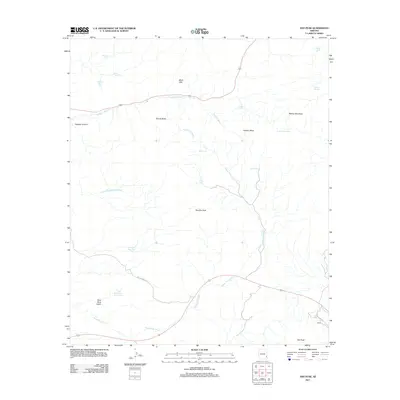
2011 Map of Ash Peak
USGS Topo · Published 2011About this map
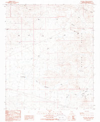
Ash Peak and the surrounding high desert terrain define this corner of Graham County, where the southern reaches of the Black Hills meet an intricate network of desert washes and peaks. The map reveals a landscape heavily shaped by water management for livestock and travelers, evidenced by numerous tanks and springs such as Yellowstone Tank, Moody Tank, and Walnut Springs. The northern portion is characterized by volcanic landmarks like Rhyolite Peak and Thumb Butte, while the south is bisected by the trace of Old US Hwy 70. The small settlement of Hardy sits along this southern corridor, providing a focal point for human activity in an area otherwise dominated by the geological features of Tollgate Canyon and Slick Rock Basin. A dense system of drainage channels, including Tollgate Wash and Shoat Tank Wash, underscores the importance of seasonal water flow across this arid basin and range environment.
Find a feature on this map
25 named features on this map. Tap any name to fly to it.
Don’t see what you’re looking for? This feature index may not catch every label — zoom into the map to look around manually.
Map Details
Editions of this 2011 Ash Peak Map
This is the sole edition of this map. No revisions or reprints were ever made.
Other maps of this area

1954 · Silver City
USGS Topo · 1:250,000

1958 · Silver City
USGS Topo · 1:250,000

1959 · York Valley
USGS Topo · 1:62,500

1960 · Guthrie
USGS Topo · 1:62,500

1960 · Duncan
USGS Topo · 1:62,500

1962 · Silver City
USGS Topo · 1:250,000
1966 · Whitlock Mts. NE
USGS Topo · 1:24,000
1966 · Dry Mountain
USGS Topo · 1:24,000
1985 · Gila Box
USGS Topo · 1:24,000
1985 · Tollgate Tank
USGS Topo · 1:24,000