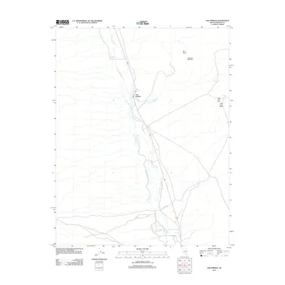
2012 Map of Ash Springs
USGS Topo · Published 2012About this map
Ash Springs serves as the focal point of this Nevada desert valley, where water management is the defining characteristic of the landscape. The passage of Pahranagat Creek through the center of the sheet is supported by an intricate network of irrigation channels, including the Number Four Ditch, Number Three Ditch, and New East Ditch. These features illustrate the vital role of water engineering in sustaining life and agriculture in Lincoln County's arid environment.
Find a feature on this map
16 named features on this map. Tap any name to fly to it.
Don’t see what you’re looking for? This feature index may not catch every label — zoom into the map to look around manually.
Map Details
Editions of this 2012 Ash Springs Map
This is the sole edition of this map. No revisions or reprints were ever made.
Other maps of this area

1945 · Alamo
USGS Topo · 1:125,000

1954 · Caliente
USGS Topo · 1:250,000

1959 · Caliente
USGS Topo · 1:250,000

1969 · Alamo SE
USGS Topo · 1:24,000

1969 · Alamo NE
USGS Topo · 1:24,000

1969 · Alamo
USGS Topo · 1:24,000

1969 · Ash Springs
USGS Topo · 1:24,000

1970 · Hiko SE
USGS Topo · 1:24,000

1970 · Hiko
USGS Topo · 1:24,000
1980 · Alamo
USGS Topo · 1:24,000