
1969 Map of Alamo NE
USGS Topo · Published 1973About this map
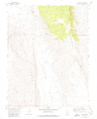
Six Mile Flat and the surrounding desert peaks of Lincoln County are captured in this late-1960s survey. The landscape is defined by the parallel elevations of the Hiko Range to the west and the South Pahroc Range to the east, which frame the broad Eightmile Valley. These topographical features reflect the classic basin and range structure of the Nevada interior. Water sources, essential for any activity in this arid environment, are specifically documented at Sixmile Spring, Eightmile Spring, and Twin Springs. A single Jeep Trail and several water tanks are the primary indicators of human presence and ranching infrastructure. The map provides a detailed view of the drainage patterns, particularly within Hells Acres Gulch, as they descend from the high ground into the flats.
Find a feature on this map
10 named features on this map. Tap any name to fly to it.
Don’t see what you’re looking for? This feature index may not catch every label — zoom into the map to look around manually.
Map Details
Editions of this 1969 Alamo NE Map
2 editions found
Other maps of this area

1885 · Pioche
USGS Topo · 1:250,000

1886 · Pioche
USGS Topo · 1:250,000

1945 · Alamo
USGS Topo · 1:125,000

1954 · Caliente
USGS Topo · 1:250,000

1959 · Caliente
USGS Topo · 1:250,000

1969 · Alamo SE
USGS Topo · 1:24,000

1969 · Alamo
USGS Topo · 1:24,000

1969 · Delamar NW
USGS Topo · 1:24,000

1969 · Ash Springs
USGS Topo · 1:24,000
1969 · Delamar Lake
USGS Topo · 1:24,000