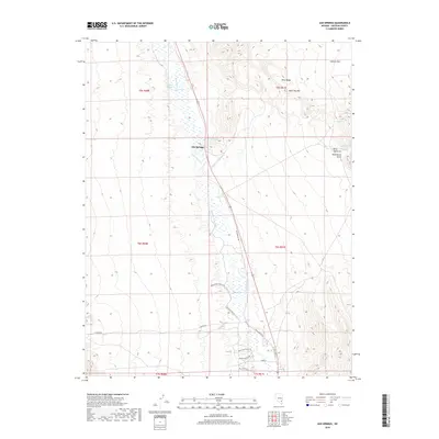
2018 Map of Ash Springs
USGS Topo · Published 2018About this map
Ash Springs sits at the heart of this desert valley, where an intricate network of irrigation channels like Number Three Ditch and New E Ditch suggests a long-standing reliance on local hydrology for ranching and agriculture. The landscape is defined by the stark contrast between the low-lying wetlands of Pahranagat Cr and the high elevations of the Hiko Range, which dominates the eastern portion of the sheet. Notable peaks and landmarks include Table Top Mtn and the evocatively named Hells Half Acre.
Find a feature on this map
28 named features on this map. Tap any name to fly to it.
Don’t see what you’re looking for? This feature index may not catch every label — zoom into the map to look around manually.
Map Details
Editions of this 2018 Ash Springs Map
This is the sole edition of this map. No revisions or reprints were ever made.
Other maps of this area

1945 · Alamo
USGS Topo · 1:125,000

1954 · Caliente
USGS Topo · 1:250,000

1959 · Caliente
USGS Topo · 1:250,000

1969 · Alamo SE
USGS Topo · 1:24,000

1969 · Alamo NE
USGS Topo · 1:24,000

1969 · Alamo
USGS Topo · 1:24,000

1969 · Ash Springs
USGS Topo · 1:24,000

1970 · Hiko SE
USGS Topo · 1:24,000

1970 · Hiko
USGS Topo · 1:24,000
1980 · Alamo
USGS Topo · 1:24,000