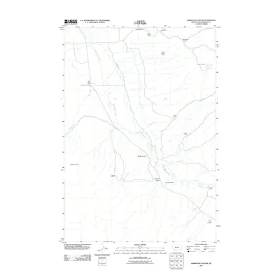
2011 Map of Ashbough Canyon
USGS Topo · Published 2011About this map
Blacktail Deer Creek meanders through this landscape, defining the layout of ranching and mining operations in this corner of Beaverhead County. The map shows a clear pattern of high-altitude resource extraction, with sites like the Ground Hog Mine, Smith Dillon Mine, and Nevada Mine dotting the drainages and canyon walls. These industrial sites are interspersed with established family holdings, including the Rock Island Ranch and Conover Ranch, illustrating the dual reliance on mineral wealth and livestock that shaped the region's economy. High-country landmarks such as Irishmans Hole and Ashbough Canyon provide topographic context for the winding Brown Rd and Blacktail Rd, while the Poindexter Cemetery offers a poignant anchor for genealogical researchers tracing the early families who settled along Sheep Creek.
Find a feature on this map
24 named features on this map. Tap any name to fly to it.
Don’t see what you’re looking for? This feature index may not catch every label — zoom into the map to look around manually.
Map Details
Editions of this 2011 Ashbough Canyon Map
This is the sole edition of this map. No revisions or reprints were ever made.
Other maps of this area

1893 · Dillon
USGS Topo · 1:250,000

1952 · Gallagher Mountain
USGS Topo · 1:24,000

1955 · Dubois
USGS Topo · 1:250,000

1955 · Dillon
USGS Topo · 1:250,000

1957 · Dillon
USGS Topo · 1:250,000

1958 · Dubois
USGS Topo · 1:250,000

1958 · Dillon
USGS Topo · 1:250,000

1961 · Christensen Ranch
USGS Topo · 1:24,000

1961 · Ashbough Canyon
USGS Topo · 1:24,000

1961 · Elk Gulch
USGS Topo · 1:24,000