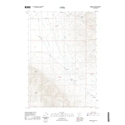
2020 Map of Ashbough Canyon
USGS Topo · Published 2020About this map
Blacktail Mountains dominate the southwestern portion of this Beaverhead County landscape, where the terrain breaks into a series of deep drainages and named canyons. The watershed is defined by Blacktail Deer Cr and its tributaries, including Sheep Cr and Timber Cr, which carve through the high country. For family historians and researchers, the presence of the Poindexter Cem near Blacktail Rd offers a specific point of genealogical interest in an otherwise sparsely populated ranching and mountain environment. The map details numerous geographical landmarks such as Irishmans Hole and Blacktail Spring, reflecting the long-standing local nomenclature of this Montana territory. The road network, including Buster Brown Rd and Cabin Creek Rd, suggests the primary access routes through the varied elevations of Ashbough Canyon and Weston Canyon.
Find a feature on this map
22 named features on this map. Tap any name to fly to it.
Don’t see what you’re looking for? This feature index may not catch every label — zoom into the map to look around manually.
Map Details
Editions of this 2020 Ashbough Canyon Map
This is the sole edition of this map. No revisions or reprints were ever made.
Other maps of this area

1893 · Dillon
USGS Topo · 1:250,000

1952 · Gallagher Mountain
USGS Topo · 1:24,000

1955 · Dubois
USGS Topo · 1:250,000

1955 · Dillon
USGS Topo · 1:250,000

1957 · Dillon
USGS Topo · 1:250,000

1958 · Dubois
USGS Topo · 1:250,000

1958 · Dillon
USGS Topo · 1:250,000

1961 · Christensen Ranch
USGS Topo · 1:24,000

1961 · Ashbough Canyon
USGS Topo · 1:24,000

1961 · Elk Gulch
USGS Topo · 1:24,000