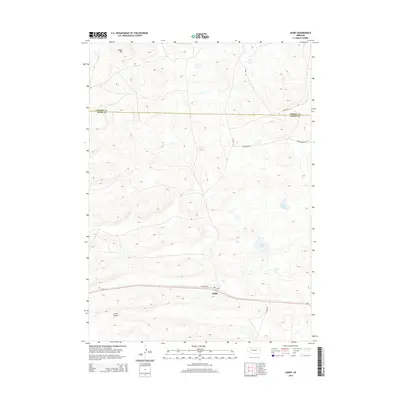
2014 Map of Ashby
USGS Topo · Published 2014About this map
Ashby anchors the southern portion of this Nebraska Sandhills region, where the Po and the corridor formed by Ne-2 and Railroad Dr represent the primary human imprint on a terrain defined by ancient dunes and high-plains depressions. The landscape transitions across the Cherry Co Grant Co boundary, moving from the prominent elevation of Indian Hill in the northwest down toward Larkin Valley. A series of isolated water bodies, including Knox Lake, Hibbler Lake, and Calkin Lake, dot the eastern side of the quadrangle, illustrating the unique hydrology of this cattle-ranching country where the water table meets the surface in the valleys between grass-covered hills. Secondary routes like Ashby Rd and Peterson Rd provide the only access to the remote interior of these vast grazing lands.
Find a feature on this map
16 named features on this map. Tap any name to fly to it.
Don’t see what you’re looking for? This feature index may not catch every label — zoom into the map to look around manually.
Map Details
Editions of this 2014 Ashby Map
This is the sole edition of this map. No revisions or reprints were ever made.
Other maps of this area

1948 · Ashby
USGS Topo · 1:62,500

1948 · Bingham
USGS Topo · 1:62,500

1948 · George Lake
USGS Topo · 1:62,500

1949 · Ashby
USGS Topo · 1:62,500

1950 · George Lake
USGS Topo · 1:62,500

1950 · Longfellow Lake
USGS Topo · 1:62,500

1950 · Bingham
USGS Topo · 1:62,500

1954 · Scottsbluff
USGS Topo · 1:250,000

1954 · North Platte
USGS Topo · 1:250,000

1955 · Alliance
USGS Topo · 1:250,000