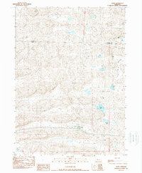
1989 Map of Ashby
USGS Topo · Published 1989About this map
The settlement of Ashby serves as the focal point of this Sandhills landscape, situated along the Burlington Northern railroad corridor. In the late 1980s, the area's geography was defined by large cattle operations and a high density of alkali and freshwater basins, such as Hibbler Lake, Knox Lake, and Calkin Lake. The presence of several named homesteads, including Thurston Ranch, Peterson Ranch, and Castle Ranch, indicates the enduring ranching economy that shaped this portion of the Nebraska panhandle. The terrain is characterized by a complex network of dunes and valleys, with landmarks like Indian Hill and the broad Larkin Valley providing navigation points across the shifting landscape. Water features like the Mid Br Loop R and Castle Lake underscore the hydrological diversity of the region, which straddles the boundary between Cherry County and Grant County.
Find a feature on this map
13 named features on this map. Tap any name to fly to it.
Don’t see what you’re looking for? This feature index may not catch every label — zoom into the map to look around manually.
Map Details
Editions of this 1989 Ashby Map
This is the sole edition of this map. No revisions or reprints were ever made.
Other maps of this area

1948 · Ashby
USGS Topo · 1:62,500

1948 · Bingham
USGS Topo · 1:62,500

1948 · George Lake
USGS Topo · 1:62,500

1949 · Ashby
USGS Topo · 1:62,500

1950 · George Lake
USGS Topo · 1:62,500

1950 · Longfellow Lake
USGS Topo · 1:62,500

1950 · Bingham
USGS Topo · 1:62,500

1954 · Scottsbluff
USGS Topo · 1:250,000

1954 · North Platte
USGS Topo · 1:250,000

1955 · Alliance
USGS Topo · 1:250,000