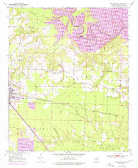
1950 Map of Ashdown East
USGS Topo · Published 1976About this map
The city of Ashdown serves as a focal point for this survey of Little River County, where the transition from agriculture to managed water resources is clearly visible. The eastern edge of the quadrangle is dominated by the sprawling Millwood Lake, a landscape feature that significantly altered the path of the Little River. Near the lake, the Peyton Public Use Area and associated Campground reflect the area's development for recreation following the reservoir's creation.
Find a feature on this map
31 named features on this map. Tap any name to fly to it.
Don’t see what you’re looking for? This feature index may not catch every label — zoom into the map to look around manually.
Map Details
Editions of this 1950 Ashdown East Map
2 editions found
Other maps of this area

1950 · Ashdown East
USGS Topo · 1:24,000

1950 · Ashdown West
USGS Topo · 1:24,000

1950 · Ogden
USGS Topo · 1:24,000

1950 · Red Bluff
USGS Topo · 1:24,000

1950 · Ben Lomond
USGS Topo · 1:24,000

1950 · Barkman
USGS Topo · 1:24,000

1950 · Falls Chapel
USGS Topo · 1:24,000

1951 · Ben Lomond
USGS Topo · 1:24,000

1951 · Ashdown West
USGS Topo · 1:24,000

1951 · Ogden
USGS Topo · 1:24,000