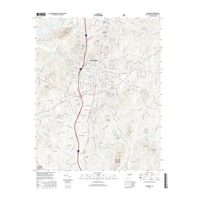
2016 Map of Asheboro
USGS Topo · Published 2016About this map
Asheboro serves as the central hub of this survey, where the Norfolk Southern rail line traverses a landscape defined by significant topographic relief. To the south, the terrain descends toward the Uwharrie National Forest, a region characterized by a series of prominent peaks and ridges including Purgatory Mtn, Stack Rock Mtn, and the descriptive Schoolhouse Ridge. The area's hydrology is complex, with the Little River and its numerous tributaries like Taylors Cr and Vestal Cr carving through the Piedmont hills.
Find a feature on this map
196 named features on this map. Tap any name to fly to it.
Don’t see what you’re looking for? This feature index may not catch every label — zoom into the map to look around manually.
Map Details
Editions of this 2016 Asheboro Map
This is the sole edition of this map. No revisions or reprints were ever made.
Other maps of this area

1953 · Raleigh
USGS Topo · 1:250,000

1954 · Raleigh
USGS Topo · 1:250,000

1957 · Asheboro
USGS Topo · 1:62,500

1968 · Ramseur
USGS Topo · 1:24,000

1968 · Erect
USGS Topo · 1:24,000

1970 · Randleman
USGS Topo · 1:24,000
1970 · Glenola
USGS Topo · 1:24,000

1970 · Asheboro
USGS Topo · 1:24,000
1973 · Eleazer
USGS Topo · 1:24,000

1973 · Seagrove
USGS Topo · 1:24,000