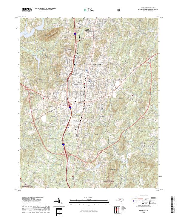
2022 Map of Asheboro
USGS Topo · Published 2022About this map
The city of Asheboro serves as a dense municipal hub in this 2022 survey, anchored by the Randolph County Courthouse and the sprawling campus of Randolph Community College. The landscape is defined by its transition from urban center to the northern reaches of the Uwharrie National Forest, where high points like Purgatory Mtn and Harveys Mtn dominate the southern horizon. The region’s hydrological network, including the Little River and Back Creek Lake, drains a series of ridges such as Schoolhouse Ridge and Cox Mtn.
Find a feature on this map
285 named features on this map. Tap any name to fly to it.
Don’t see what you’re looking for? This feature index may not catch every label — zoom into the map to look around manually.
Map Details
Editions of this 2022 Asheboro Map
This is the sole edition of this map. No revisions or reprints were ever made.
Other maps of this area

1953 · Raleigh
USGS Topo · 1:250,000

1954 · Raleigh
USGS Topo · 1:250,000

1957 · Asheboro
USGS Topo · 1:62,500

1968 · Ramseur
USGS Topo · 1:24,000

1968 · Erect
USGS Topo · 1:24,000

1970 · Randleman
USGS Topo · 1:24,000
1970 · Glenola
USGS Topo · 1:24,000

1970 · Asheboro
USGS Topo · 1:24,000
1973 · Eleazer
USGS Topo · 1:24,000

1973 · Seagrove
USGS Topo · 1:24,000