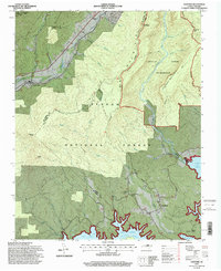
1994 Map of Ashford
USGS Topo · Published 1998About this map
Pisgah National Forest and the eastern edge of the Linville Gorge Wilderness dominate this terrain, where the North Fork Catawba River and the Linville River descend toward the northern reaches of Lake James. The map details a period of transition in the mid-1990s, where the infrastructure of the Blue Ridge Pkwy and Kistler Memorial Highway meets the older footprints of mountain communities. Local history is anchored by the Clinchfield RR corridor, which passes through North Cove and under mountains via the Honeycutt Tunnel. Genealogical markers include the South Mountain Institute and several rural burial grounds such as Brown Cemetery and Oak Grove Cemetery. The landscape transitions from the high elevations of Shortoff Mountain and Pinnacle down to the fingers of the reservoir at Longtown, illustrating the complex water and rail network that shaped the border of McDowell and Burke counties.
Find a feature on this map
50 named features on this map. Tap any name to fly to it.
Don’t see what you’re looking for? This feature index may not catch every label — zoom into the map to look around manually.
Map Details
Editions of this 1994 Ashford Map
2 editions found
Other maps of this area

1900 · Mount Mitchell
USGS Topo · 1:125,000

1902 · Mount Mitchell
USGS Topo · 1:125,000

1905 · Morganton
USGS Topo · 1:125,000

1934 · Spruce Pine
USGS Topo · 1:24,000

1934 · Linville Falls
USGS Topo · 1:24,000

1953 · Charlotte
USGS Topo · 1:250,000

1954 · Charlotte
USGS Topo · 1:250,000

1955 · Knoxville
USGS Topo · 1:250,000

1956 · Oak Hill
USGS Topo · 1:24,000

1956 · Ashford
USGS Topo · 1:24,000