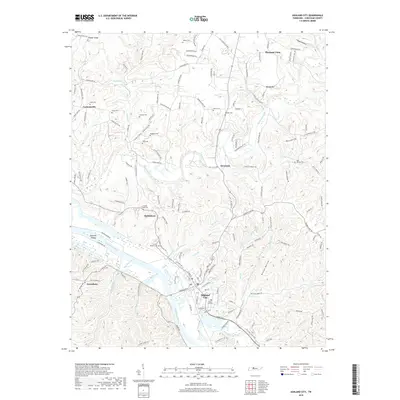
2019 Map of Ashland City
USGS Topo · Published 2019About this map
Ashland City anchors this topographic study along a winding stretch of the Cumberland River, where the landscape is defined by deep hollows and the drainages of Marrowbone Creek and Big Bluff Creek. The terrain is marked by numerous family and community burial grounds, such as Forest Hill Cem and Fannie Field Cem, which serve as vital landmarks for genealogists tracing local lineage in Cheatham County. To the north, the upland settlements of Pleasant View and Lockertsville are connected by historical routes like the Old Clarksville Pike. The map illustrates a complex network of smaller waterways, including Sycamore Creek and Marks Creek, which have shaped the settlement patterns from Sycamore down to the riverfront. These features collectively highlight the enduring rural character and historical geography of the region as it appeared in the late 2010s.
Find a feature on this map
156 named features on this map. Tap any name to fly to it.
Don’t see what you’re looking for? This feature index may not catch every label — zoom into the map to look around manually.
Map Details
Editions of this 2019 Ashland City Map
This is the sole edition of this map. No revisions or reprints were ever made.
Other maps of this area

1903 · Nashville
USGS Topo · 1:125,000

1930 · White Bluff
USGS Topo · 1:62,500

1931 · Ridgetop
USGS Topo · 1:62,500

1932 · Nashville
USGS Topo · 1:62,500

1933 · White Bluff
USGS Topo · 1:62,500

1935 · Ridgetop
USGS Topo · 1:62,500

1955 · Forest Grove
USGS Topo · 1:24,000

1955 · Scottsboro
USGS Topo · 1:24,000

1956 · Nashville
USGS Topo · 1:250,000

1957 · Cheatham Dam
USGS Topo · 1:24,000