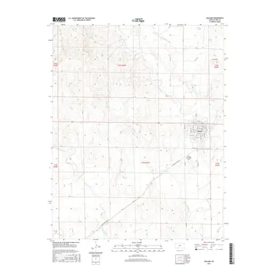
2015 Map of Ashland
USGS Topo · Published 2015About this map
Ashland serves as the central hub for this portion of Clark County, structured by a grid of streets including Main St, Cedar St, and Maple St. The town sits at the intersection of various local thoroughfares such as CR U and River Rd, while the surrounding prairie landscape is deeply etched by a network of seasonal watercourses. To the south, the Harold Krier Field Airport stands near the confluence of local drainages like Redhole Cr and Little Sandy Cr. The terrain is characterized by the branching systems of Bear Cr, with its eastern and western branches cutting through the northern uplands near Mt Casino. Modern infrastructure is evidenced by the Shortgrass Prairie Trl and Angle Rd, which navigate the subtle shifts in elevation across the township and range lines of the High Plains.
Find a feature on this map
54 named features on this map. Tap any name to fly to it.
Don’t see what you’re looking for? This feature index may not catch every label — zoom into the map to look around manually.
Map Details
Editions of this 2015 Ashland Map
This is the sole edition of this map. No revisions or reprints were ever made.
Other maps of this area

1894 · Sitka
USGS Topo · 1:62,500

1896 · Ashland
USGS Topo · 1:125,000

1955 · Pratt
USGS Topo · 1:250,000

1959 · Pratt
USGS Topo · 1:250,000

1972 · Ashland NW
USGS Topo · 1:24,000
1972 · Englewood
USGS Topo · 1:24,000
1972 · Ashland SE
USGS Topo · 1:24,000
1972 · Ashland
USGS Topo · 1:24,000

1979 · Sitka
USGS Topo · 1:24,000

1979 · Bloom SE
USGS Topo · 1:24,000