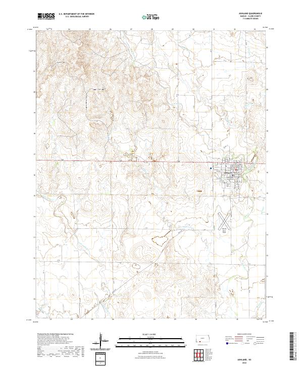
2022 Map of Ashland
USGS Topo · Published 2022About this map
Ashland serves as the focal point of this southwestern Kansas landscape, situated where the high plains meet a network of descending creek drainages. The town's grid is anchored by the Clark County Courthouse, with named streets like Santa Fe and Main St reflecting the settlement's regional importance. To the south, Harold Krier Field marks the local aviation footprint, while the surrounding terrain is deeply incised by watercourses including W Br Bear Cr, Little Sandy Cr, and Redhole Cr. These drainages create a complex topographic texture compared to the flatter uplands to the north. In the northeast, Mt Casino rises above the valley of Casino Cr, offering a distinct landmark in an area defined by the transition from open range to the breaks of the Cimarron River watershed.
Find a feature on this map
52 named features on this map. Tap any name to fly to it.
Don’t see what you’re looking for? This feature index may not catch every label — zoom into the map to look around manually.
Map Details
Editions of this 2022 Ashland Map
This is the sole edition of this map. No revisions or reprints were ever made.
Other maps of this area

1894 · Sitka
USGS Topo · 1:62,500

1896 · Ashland
USGS Topo · 1:125,000

1955 · Pratt
USGS Topo · 1:250,000

1959 · Pratt
USGS Topo · 1:250,000

1972 · Ashland NW
USGS Topo · 1:24,000
1972 · Englewood
USGS Topo · 1:24,000
1972 · Ashland SE
USGS Topo · 1:24,000
1972 · Ashland
USGS Topo · 1:24,000

1979 · Sitka
USGS Topo · 1:24,000

1979 · Bloom SE
USGS Topo · 1:24,000