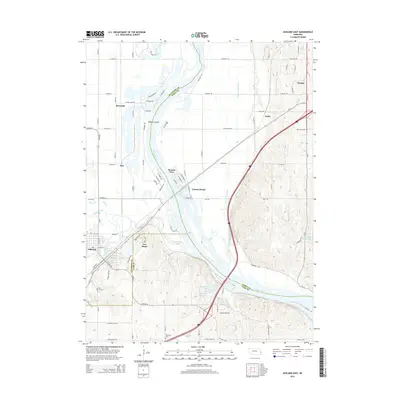
2014 Map of Ashland East
USGS Topo · Published 2014About this map
The Platte River corridor serves as the central artery for this landscape where Saunders, Sarpy, and Cass counties meet. The convergence of Wahoo Creek and Salt Creek near the city of Ashland highlights a complex hydrologic network, further defined by the Western Sarpy Ditch and the Patte River to the north. This 2014 survey documents a region defined by river-bottom geography and recreational developments like Linoma Beach and Beacon View, alongside established upland settlements such as Gretna.
Find a feature on this map
84 named features on this map. Tap any name to fly to it.
Don’t see what you’re looking for? This feature index may not catch every label — zoom into the map to look around manually.
Map Details
Editions of this 2014 Ashland East Map
This is the sole edition of this map. No revisions or reprints were ever made.
Other maps of this area

1893 · Fremont
USGS Topo · 1:125,000

1896 · Fremont
USGS Topo · 1:125,000

1903 · Weeping Water
USGS Topo · 1:125,000

1929 · Weeping Water
USGS Topo · 1:125,000

1955 · Fremont
USGS Topo · 1:250,000

1955 · Lincoln
USGS Topo · 1:250,000

1956 · Gretna
USGS Topo · 1:24,000

1956 · Springfield
USGS Topo · 1:24,000

1957 · Fremont
USGS Topo · 1:250,000

1957 · Lincoln
USGS Topo · 1:250,000